Hengifoss (Fjotsdalsheidi)
 Hengifoss is a beautiful waterfall in Fljótsdalur valley not far away from Egilsstaðir. Hengifoss, in the river Hengifossá, is 128 meters high making it the second highest waterfall in Iceland. There are several sources speaking of a height of 118 meters. The truth probably lies in between.
Hengifoss means something like “hanging waterfall”
From Egilsstaðir take road 1 to the north to Fellabær and there take the exit left to road 931 (Fljótsdalur). Follow the road for 32 kilometer until you see a parking at the right side of the road (gps 65.073316, -14.880282) This is the trailhead to Litlanesfoss and Hengifoss.
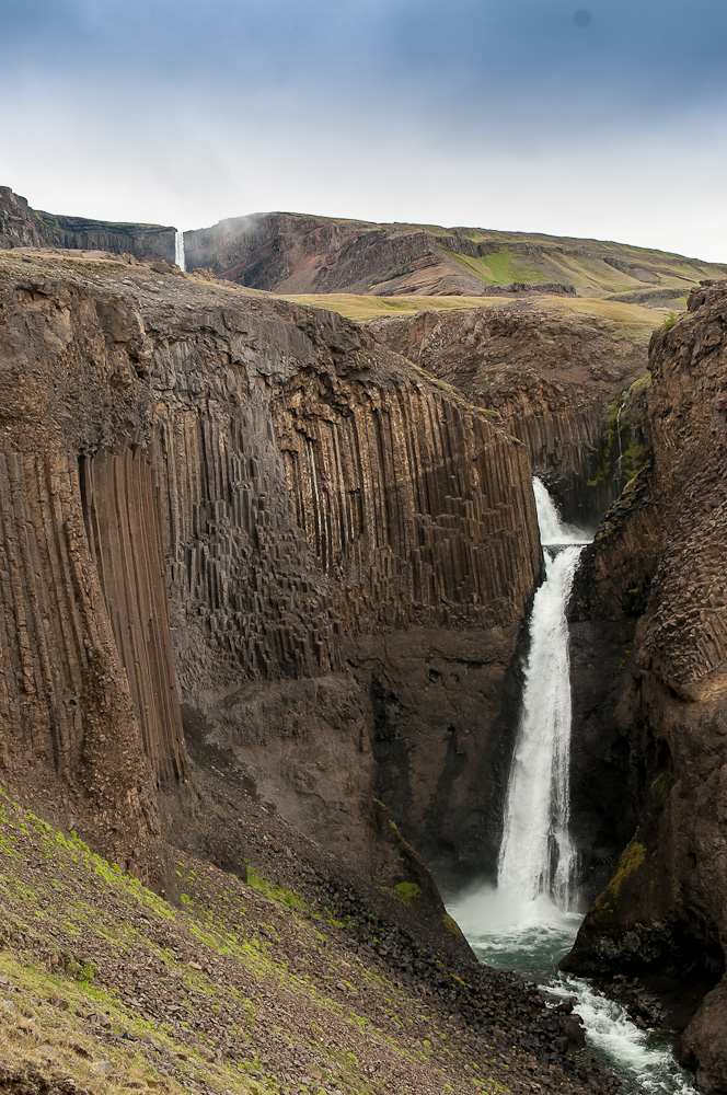
The hike up to the waterfall is not very difficult but goes up in the beginning. The walk takes about 45 minutes. The track follows more or less the river Hengifossá. After 1,5 kilometer (30 minutes) you first will see the beautiful waterfall Litlanesfoss which is surrounded by some of Iceland’s longest basalt columns.Litlanesfoss is also called Stuðlabergsfoss which means basalt column waterfall.
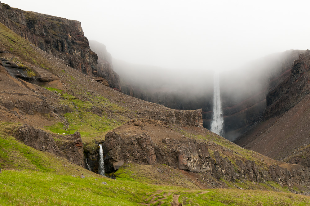
 After Litlanesfoss you already can see the impressive Hengifoss in the distance. Unfortunately the waterfall was during our visit partially covered with clouds. From Litlanesfoss you can walk further to the base of Hengifoss but we stopped at a viewpoint after 15 minutes from Litlanesfoss because of the limited vision.
From the parking it is a 2,5 kilometer walk to the base of Hengifoss. The ascend of the walk is approximately 260 meter. More information about the hike can be found on Wikiloc.
On our way back the clouds disappeared a little so we still had a glimpse on Hengifoss. Nevertheless Hengifoss belong to the most beautiful waterfalls of Iceland!
Best time to visit Hengifoss is early summer when there aren’t to many tourists. When you visit Hengifoss early in the morning, the light for taking pictures is on its best.
The origin of the river Hengifossá lies up at Hengifossárvatn which is located in the moorland of Fljótsdalasheiði. Hengifossárvatn is located at an altitude of 660 meter.
What makes the Hengifoss special is the visible red layers behind the fall. Each layer (Paleosols) is another period with a different climate. The paleosol is also called fossil soil. These are very valuable for climate predictions. The soil is fossilized by (sudden) or volcanic sedimentation deposition. In hydrogeology such layer is called a scrambled egg layer. In the lower left corner of the waterfall is a mini basalt layer with basalt columns.
For a list with all waterfalls in Iceland or a map with all waterfalls in Iceland, go to the main Iceland section.


First time I visited Hengifoss, I could see it really beautiful. Second time, I walked towards the waterfall, but I haven’t seen it because of the clouds. But still, it’s a great waterfall, also in combination with litlanesfoss.