Glomnesfossen
(Glomsfossen)
Glomnesfossen or Glomsfossen is an unknown, but big, waterfall near Hjelle at Oppstrynsvatnet in the region Sogn og Fjordane, Norway.
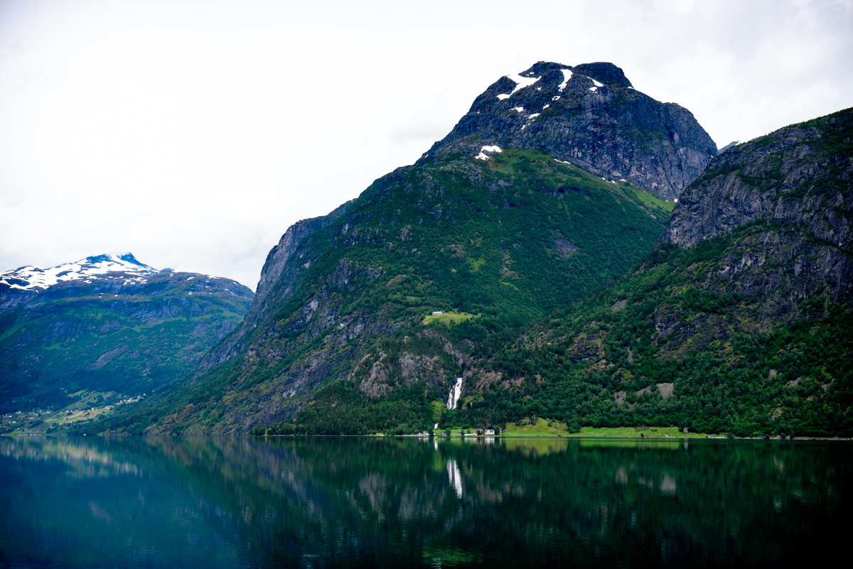
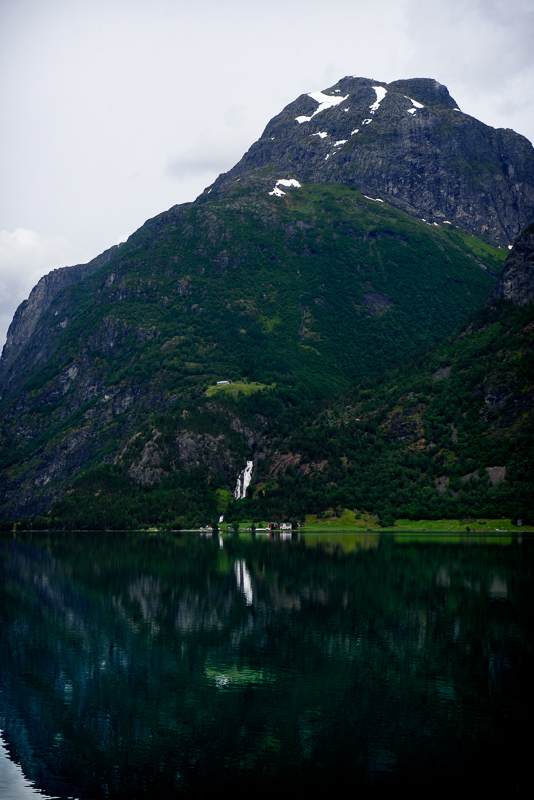 Driving along the Oppstrynsvatnet, from Oppstryn to Grotli, you will see a waterfall at the other side of the lake, just before Hjelletunnel at Hjelle. Just before the tunnel you can go left to a viewpoint and Hjelle. A few hundred meter further you will have an amazing view on the lake, mountains and Glomnesfossen at the right. A perfect picture, but it still doesn’t show the power and beauty of Glomnesfossen.
If you drive further to Hjelle you can go left to Glomnes. Don’t speed to much, there are speedbumps in the road. Further down the (dirt) road it is prohibited for cars and you have to park the car at a small parking (payed).
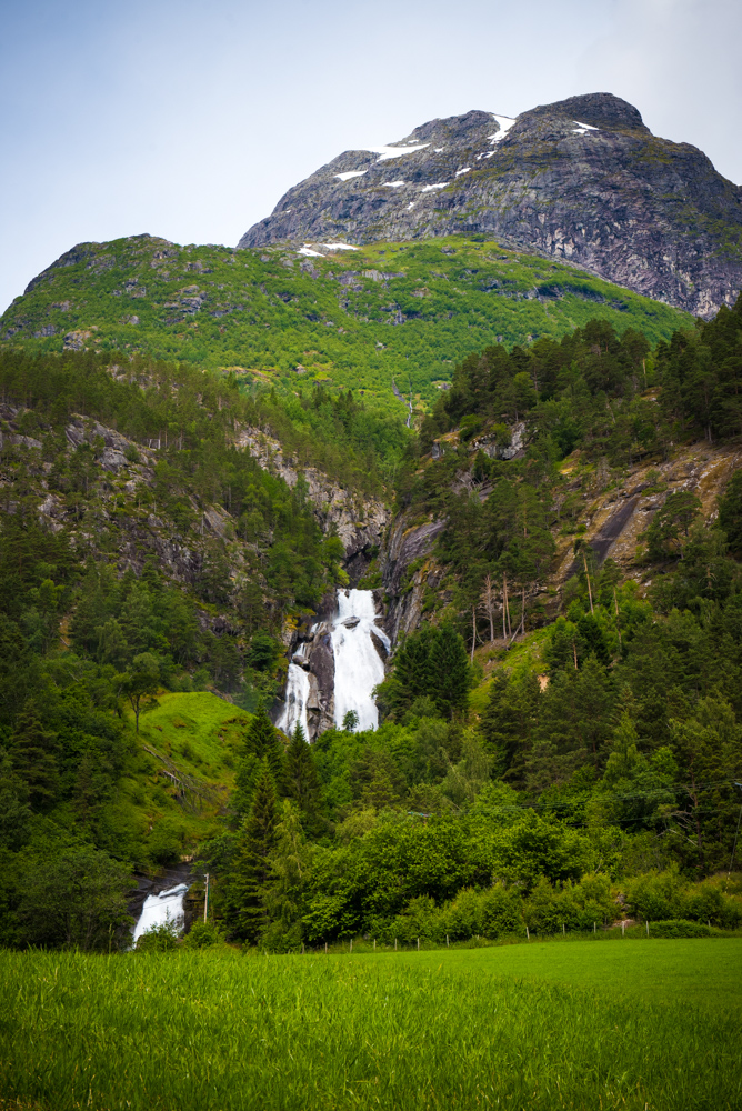
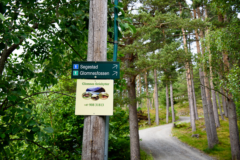 In 5-10 minutes you have to walk to the house. At the right side you already see Glomnesfossen at the end of the meadow. Walk further, passing the houses until you see a sign “Glomnesfossen” pointing right, just after crossing the river.
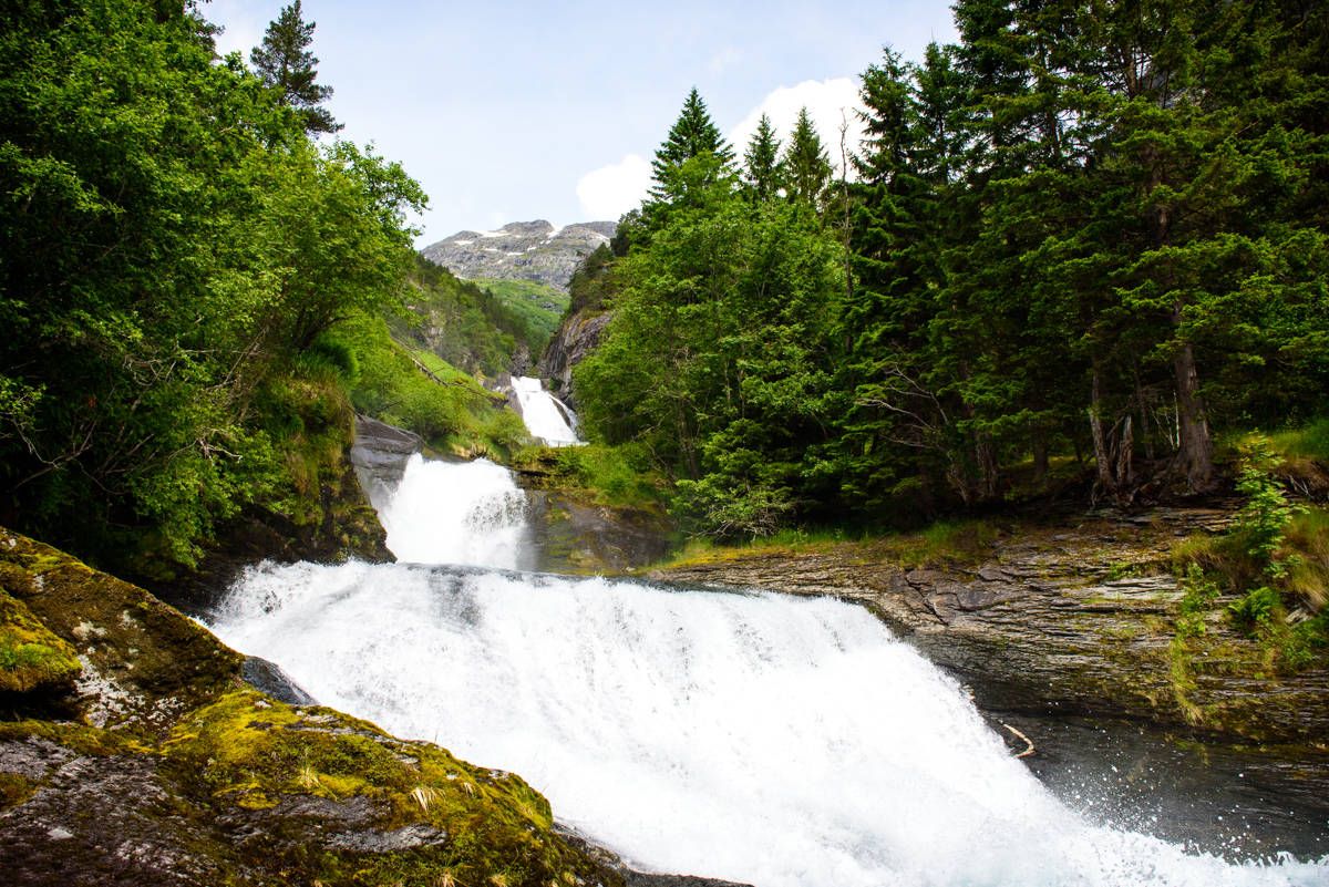
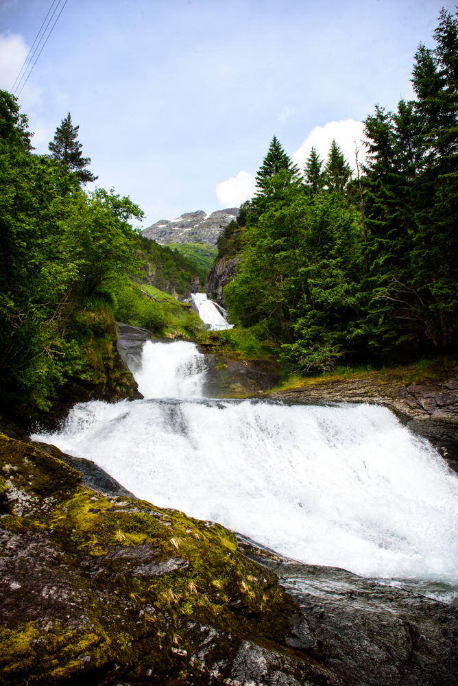
Here I got confused because I walked to the river and followed the river upstream on an unofficial path. Here you have a very beautiful view on the lower part of Glomnesfossen. Afterwards I realized I had to follow the path up to see the powerful upper part of Glomnesfossen, in 5-10 minutes time…
 Nevertheless I shot some nice pictures and I am glad I checked out Glomnesfossen. It is difficult to determine how high Glomnesfossen is. Looking at the pictures and surveying the map I think Glomnesfossen is appr. 130 meter high.
The river Glomsdøla runs far into the Glomsdalen (12,9 km) and is fed by melted snow and ice from several small glaciers. Not all of them are named but Nautbreen is one of them. The average volume of Glomsfossen is 2,45 m³/s. The river is protected against any power development.
If you like hiking, the parking is a popular starting point for several walks. One of the walks goes along the waterfall to Segestad (60 minutes). Here you have a great view on the Oppstrynsvatnet and valley. You can view the trail on Google maps here. There is a possibility to walk further into the Glomnesdalen to Glomnessaetra.
There are many nice things to do in the area of the Oppstrynsvatnet/Stryn:
- Visiting the Gudbrandsjuvet
- Drive the Gamle Strynefjellsveg and see Ovstebrufossen and Buldrefossen
- Enjoy the Lodalen (Loen) and Kjenndalen with its many waterfalls, like Ramnefjellfossen