Stäuber (Engelberg)
(Stauber I&II, Stierenbachfall)
The Stäuber wasserfall, also called Stierenbachfall, is one of the more voluminous waterfalls near Engelberg in the region Obwalden, Switzerland. This is also one of the official named waterfalls in the Surenen valley.
From Stans (road 2) take the exit to Engelberg and continue to Engelberg. There you have to go right following the signs “Furenalp” and “wasserfall”. The waterfall is located almost at the end of the valley. There are several options to get at the Stäuber wasserfall:
- From the cable station “Furenalp bahn (gps 46.801584, 8.449486)” go up to the Furenalp and descend down to the Stäuber wasserfall. This is a hike over 9 km with a descend of 760 m and takes appr. 3-3,5 hours (roundtrip).
- You can hike from the cable station to the Stäuber wasserfall. From the parking at the “Furenalp bahn” it is a 100-130 min walk (6.2 km one way) to the Stäuber wasserfall, located at the right side of the track. The walk takes you along the river Stierenbach with some nice waterfalls.
- I am not sure about this option but if possible: From the cable station you can pay toll to drive a little further down into the valley to the parking Bründler. From here it is a 75-90 min walk (4,3 km one way). Maybe you even can drive up to restaurant Stäfeli, then you are quite near the Stäuber wasserfall (appr. 1 kilometer).
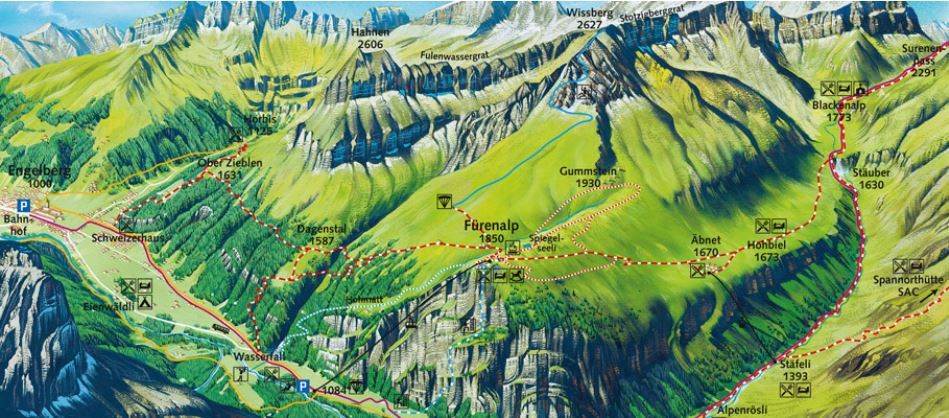
There are many other low volume waterfalls in the valley also very suitable for hiking.